Metadata: Call up Catalog Services for the Web (CSW) in the viewer
A Catalogue Service for the Web (CSW) is the Internet-supported publication of information about geoapplications, geoservices and geodata (metadata) in a geodata infrastructure.
If you have already described your geodata or geoservices via a CSW, you can use this external catalog service in PlexMap.
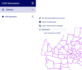
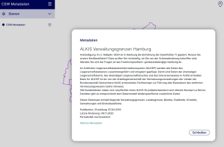
Once you have completed this tutorial, the metadata transferred via the CSW will be displayed in the PlexMap Viewer.
Link catalog service with a layer Anchor
The CSW is linked to the PlexMap Viewer for each layer. To link the desired layer to your CSW, first navigate to the "Layers" main menu in the PlexMap backend. Search for the layer to be linked and then click on the settings wheel (Edit layer). A popup with the layer settings will now appear.
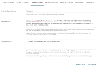
The parameters of your CSW can be entered in the "Presentation" submenu of the layer settings (see illustration):
Description titleMetadatenDescription{{show_csw_metadata("URL der CSW Schnittstelle", "Objekt-ID des Services")}}
[Weitere Metadaten](URL weiterer Metadaten)Legend graphicexample.png
Now click on "Save" to complete the process.


