Display georeferenced photos in PlexMap 3D
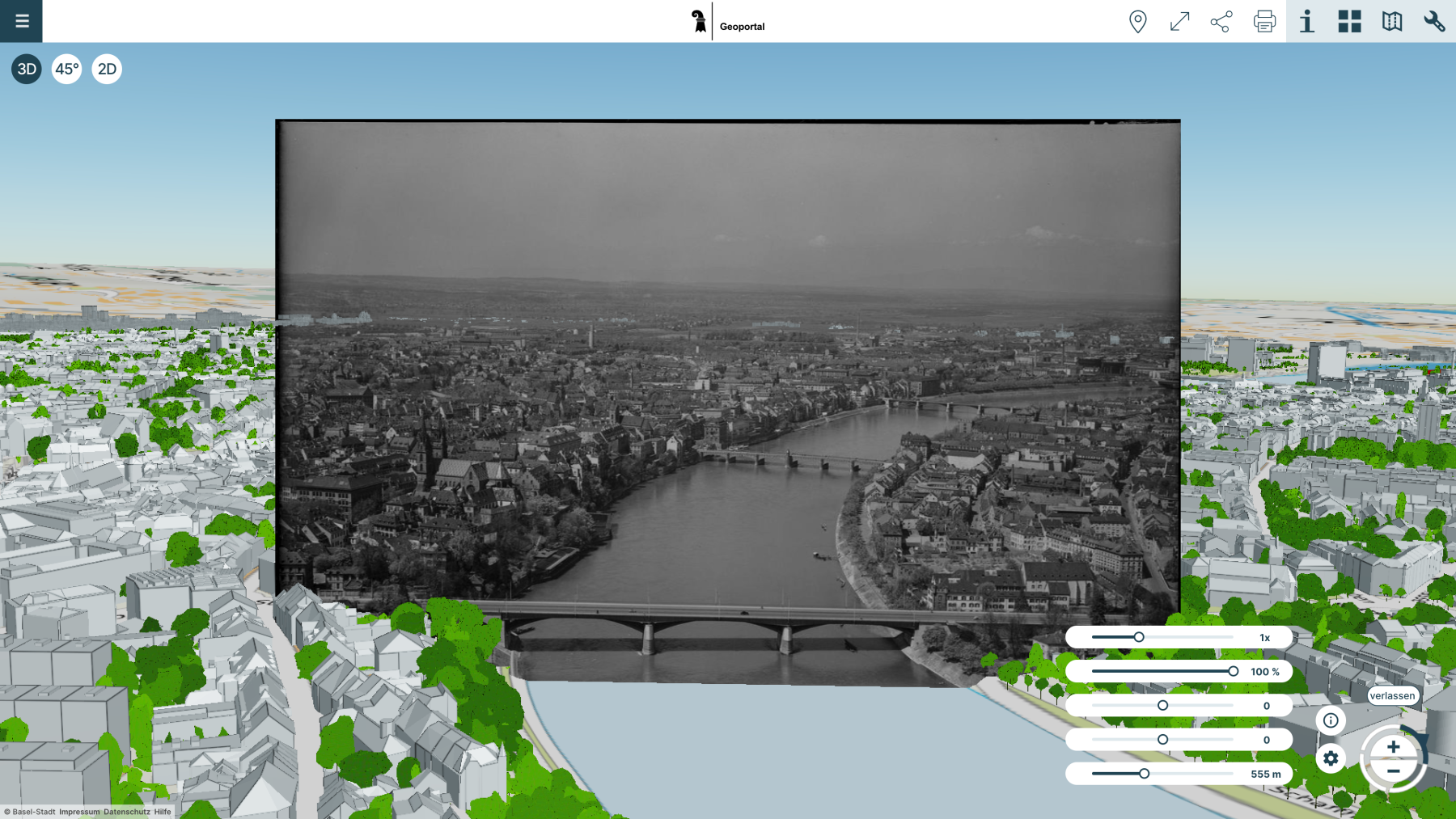
The Oriented-Image data type can be used to display any georeferenced photos in PlexMap 3D (e.g., drone images, historical aerial photographs, street images). The finished images are displayed in the viewer as points in 3D space and can be opened with a mouse click and visualized against the current 3D city model. Various sliders allow, for example, manipulating the transparency and brightness of the images (see figure).
The Oriented-Image data type is central to integrating photos into PlexMap 3D and describes the capture center of an oriented photo for integration into PlexMap 3D.
Using this data type requires licenses for the PlexMap backend, PlexMap 3D, and PlexMap Street360°.
This tutorial will teach you how to integrate photos into PlexMap 3D using Oriented-Image.
Here you can access a demo with oriented historical images of the island of Lindau.
Integration of drone photos into PlexMap 3D Anchor
If the image data is photos from a drone, you can usually read the orientation of the images directly from the drone flight. Most drones (e.g., DJI, Autel, Parrot) write GPS data directly into the EXIF metadata of the JPEG or RAW files. Heading/pitch/roll should also be included in manufacturer-specific tags.
The subsequent preparation of the images can be done using QGIS:
1. Open QGIS.
2. Load photos as a "photo layer": Layer -> Add Layer -> Add Photos.
3. The EXIF GPS data is automatically detected and placed as points.
4. Open the attribute table and export it as CSV/Excel.
Alternatively, you can write a Python script, for example, that reads all photos in a folder and writes latitude, longitude, altitude, yaw, pitch, and roll directly to a CSV file.
The generated table can now be imported into the PlexMap Switchboard to populate the Oriented-Image data type. You can now use Store in Layer to write a layer from the Oriented-Image and then add it to a 3D view. If you encounter any problems, please contact our support team.

Integration of other photos via sMapshot Anchor
If your photos aren't yet georeferenced, PlexMap offers an interface to sMapshot. The platform allows you to align images over a virtual globe to georeference them in three dimensions.
In sMapshot, photos are manually georeferenced by the user identifying prominent points in the photo and linking them to the real-world position on a 3D map (globe). The system uses Ground Control Points (GCPs), which are set by the user, to calculate the camera position and orientation. You can learn how this works in detail here.
Once the images are stored in sMapshot, they can be retrieved in the PlexMap Switchboard using Query sMapshot. The function expects a bounding box of the area in which your photos are located as input. In the example switchboard (see figure), a bounding box was created for any point cloud that happens to be located in the area in question. The photos can then be saved to a depot using Store in Depot or directly to a layer using Store in Layer.
Before writing the layer, you can download the images from sMapshot to PlexMap using Download Images. This prevents your view from being affected if sMapshot is unavailable.
