Create contours for 3D city models
Edges can be created and visualised in the 3D viewer for 3D city models that are displayed via the "Mesh" layer type in PlexMap 3D.
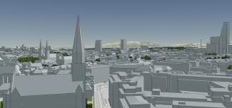
This option is particularly suitable for realising planning representations with your own 3D city model (see figure: Contours using the example of the 3D city model of the Canton of Basel-Stadt).
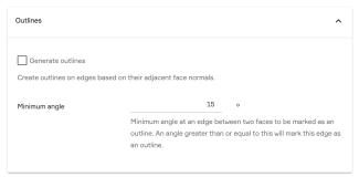
To display outlines in the 3D city model, activate the "Generate outlines" option in the layer settings of your 3D mesh layer (see illustration).
You can use the "Minimum angle" option to specify the angle from which a contour is created between two surfaces. The default setting is 15 degrees.
If this is a layer that already exists, you must save the layer again in the corresponding switchboard for the changes to take effect.

